Downtown Development Initiative: Our Fair City Before Lot #5
Friday, December 1st, 2006Making some progress on a GoogleEarth visualization of downtown.
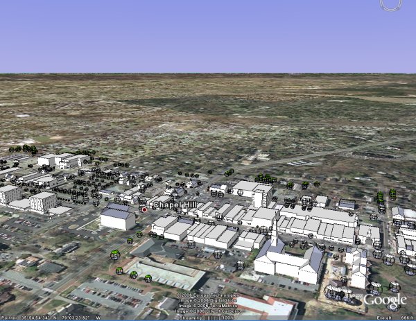
Here’s some data if you want to either visualize Chapel Hill within GoogleEarth or want to start fresh with a re-import. Small caveat on the GoogleEarth import – don’t turn on the terrain as I still need to tweak the elevations to get the right output.
If anyone manages to adjust the terrain before Sunday, please consider routing the changes back my way….
Tools:
Data:
- Chapel Hill GE KMZ Model File
- AutoCad 3D Model [ZIP] (provided by CH Planning – thanks Gordon)
- 3dStudio [ZIP]
Hope to have Granville Towers and RAM’s Lot 5 proposal by Sunday. And, with any luck, a decent flyby to demonstrate the visual impact of the 104′ leviathan.